Safe Routes to School

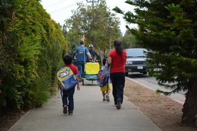
Walk to School Day 2015

Every year, the Valley Transportation Authority makes grants available through their Vehicle Emissions Reductions Based at Schools program to fund education programs through Safe Routes to Schools programs. Such programs encourage students of schools in Santa Clara County to walk or bike to school to reduce morning commute congestion.

Safe Routes to School refers to a variety of multi-disciplinary programs aimed at both increasing the number of students walking and bicycling to school and reducing the number of vehicle trips associated with school travel on a national or statewide level. 


May is Bike Month!

May is Bike Month and the City of Los Altos, GreenTown Los Altos, Safe Routes to Downtown Los Altos, City of Los Altos Hills, Los Altos Village Association and many other community members are teaming up to plan activities and events to roll our way through May! 

Learn More


International Walk to School Day

The whole month of October, celebrate International Walk to School Day by walking or wheeling with your friends, family, and neighbors to school! Walk to School Day is an international celebration that promotes walking and biking to school to recognize the importance of safe and active transportation.

The city of Los Altos encourages all elementary, middle, or high schools to participate.

Learn More


Student and Family Travel Data

Los Altos Safe Routes to School collects data on how students travel to and from school and what are parents' and caregivers' concerns and motives for walking or biking with their children.

Learn More


Los Altos Walk and Wheel Champion Toolkit  

This guide is designed to help SRTS champions, school administrations, parents, and community members prepare for and foster participation in a Walk or Wheel (Wow!) to School Day events by providing monthly resources, flyers, poster templates, safety tips, and fun activity ideas.

Learn More


Monthly Theme Messaging Toolkit for School Administration

This toolkit was developed to help school administrators communicate to parents, caregivers, and students about safe and active travel to school. The toolkit contains templates of monthly themed messages, easy to use and adaptable for each school. This communication is a first step in reducing congestion near schools, improving driving behaviors and encouraging active transportation and alternative transportation modes to the family vehicle to travel to school. We hope that all schools share that information consistently each month.

Learn More


Walk n Roll Map

The Safe Routes to School team has implemented an app to better view the various walk and roll maps. You can view the map at schoolroutes.org or download it from the Apple App store at "School Routes".  Select your city (Los Altos or Cupertino) then the school that you are looking for. This app will use your location to show you where you are on the map. 

These maps are helpful to show which routes are the safest and where stoplights, stop signs, and crossing guards are. You can toggle the legend on and off at the bottom left side of the page and change the school or area you are looking at. 


Suggested Routes to School Maps

These suggested route maps generally include recommended sidewalks and bikeways that help guide parents and students while walking or biking to area schools.